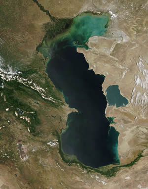
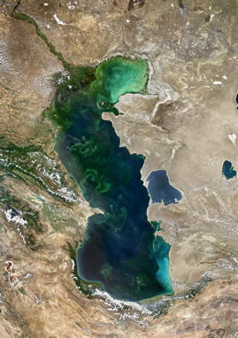
Currently, much attention is given to the integrated study of the Caspian Sea. And this is due not only to the intensive development of oil and gas production and significant changes in the regional climate, but also due to the continuing fluctuations in the level of the Caspian Sea. Over the course of the instrumental observations (since 1837), the amplitude of the Caspian Sea level variations was more than 3 m.
The volume of regular hydrological studies of the sea as well as the amount of information from meteorological stations and hydrometeorological stations has significantly decreased over the past 25 years. In comparison with 1960, the network of meteorological stations and sea-level stations in the Caspian Sea has rapidly decreased almost threefold, and their technical equipment has run its course. The exchange of data between the states of the Caspian region is also difficult.
Tide gauge stations carry out measurements near the coastline with different accuracy and temporal resolution without a unified altitude reference. In most cases, both the features of the terrain and the outlines of the coastline have a significant impact on the measurement accuracy. The accuracy of level measurements is also influenced by modern vertical movements of the earth's crust in the Caspian region, which, along the coast, differ not only in size but also in direction. This introduces a significant error into the calculations of the interannual sea level variability. The use of satellite altimetry can not only compensate for the loss of traditional information, but also provide an opportunity to investigate changes in the level of the Caspian Sea in its entire area.
 |
 |
The rise of the level of the Caspian Sea by 2.5 m from 1978 to 1995 led to destruction of villages and infrastructure in a wide (up to 50–70 km) strip of the coastal zone of Kalmykia (Lagansky district) and Kazakhstan, to flooding 320 thousand hectares of valuable land, increasing the level of groundwater, flooding and salinization of soils, railways and highways, power and telephone lines, disruption of gas pipelines, pollution of sea waters as a result of the flooding of oil wells. 260 thousand people resided in the flood zone, and the total impact of this sea level rise affected 7 million hectares of land, where about 600,000 people lived in Dagestan alone. The economic damage to Russia due to the rise in sea level, according to various estimates, amounted to 0.5–1 billion US dollars at that time. The total cumulative direct damage to the Caspian countries, according to WMO, was about $15 billion by 1995.
 |
 |
The flat slopes of the coastal plain of Kalmykia contribute to the deep penetration of sea water, especially during storm surges. 2–3 m high upsurge events can flood 20–30 km deep into the coastal zone. While downsurge events can expose large areas of the coast up to 0.5 m (usually lower than upsurge events).
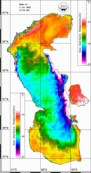
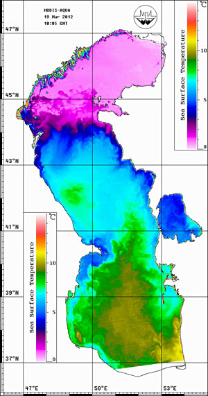
The increase of cold winters came unexpected amid the continuing regional warming in the 2000s. For example, in January 2012, the Northern Caspian Sea was covered in ice (fast ice was observed even in the port of Makhachkala), the Turkmenbashi Bay (Krasnovodsky) froze in the Southern Caspian Sea, which significantly disrupted transport communications. If the well-known forecasts come true, we can expect a new series of cold winters in the regions of the Southern Seas of Russia in the next decade. Nevertheless, the tendency to warming of the Southern seas of Russia due to the increase in air and water temperature and, consequently, the tendency to a decrease in ice coverage and ice thickness will lead to an increase in the navigation period for maritime navigation in the Northern Caspian Sea, as well as decrease the risk of operating offshore drilling platforms and pipelines.
 |
 |
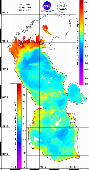
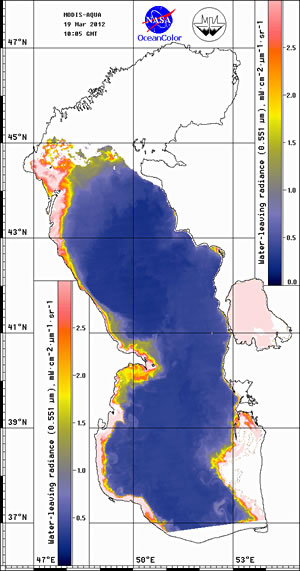
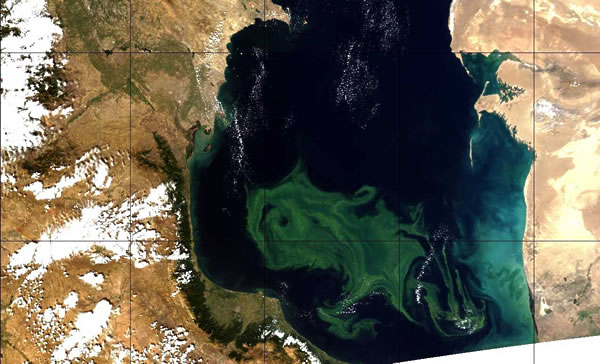
So far, due to inadequate monitoring, there is no understanding of the exact ratio of pollution from land, sea and atmospheric sources. The process of replenishing the waters of the Caspian Sea is very slow compared to other seas. As a result, the threshold of adverse effects of pollutants, at which irreversible effects occur in the marine ecosystem, is significantly reduced. Therefore, the industrial development of the Caspian oil and gas resources is inevitably becoming an additional, and in the coming years, perhaps the main source of anthropogenic environmental impact on the Caspian Sea. This is due to the development of the recently discovered vast oil fields and its transportation to world markets.
When assessing the environmental risk, special attention is paid to the analysis of natural factors in the origin of emergency situations. In the Caspian, such natural factors include storm winds, ice conditions (Northern Caspian Sea), sea level fluctuations, surge events, extreme waves, dangerous geological and geomorphological conditions (earthquakes, gas-saturated zones). A key element of these factors is the very limited ability to predict the time of their occurrence and the severity of their consequences.
Geological and geomorphological phenomena are more diverse, less predictable, and therefore more dangerous. The ongoing exploratory drilling and the oil and gas fields planned for intensive development on the shelf of the Caspian Sea are in the zone of increased seismic risk. The Southern and most of the Middle Caspian are exposed to significant geodynamic hazards associated with seismicity. In addition, the bottom of the Caspian Sea is subject to mud volcanism. Statistically, up to a 1,000 earthquakes of up to 3 points on the Richter scale occur in the Caspian waters, and the number of minor earthquakes amounts to many thousands. The Atyrau region of Kazakhstan, including the Caspian Sea, is one of the areas of the earth's crust with the possibility of earthquakes of magnitude up to 6 on the Richter scale. And Kashagan, Kairan, Korolev, Tengiz, the large oil and gas fields, are located within tectonically active areas. Studies conducted by Iranian experts show that the southern Iranian coast of the Caspian Sea is prone to earthquakes and landslides, especially in the central part of the coast from the city of Amirabad to the city of Nur and from the city of Bandar-e Anzali to the city of Rezvanshahr.